Komló (Komlói Járás)
Komló (, Kumlau, Komlov) is a town in Baranya county, Hungary. The name of the settlement is derived from the local crop of hops (komló), an ingredient of beer. By the 18th century a depiction of this plant running up a support already featured on the herald of the town.
The former village of Komló became a planned mining city during the socialist era. It was the second biggest mining centre in Hungary after Tatabánya.
The area was inhabited by the Romans, the ruins of 2nd-century Roman villas were discovered during the laying of foundations for new buildings in the area (Mecsekjánosi, Körtvélyes). The existence of the once village is first mentioned in a charter from 1256 as 'villa Compleov', then part of the estates of the Pécsvárad Abbey.
The small settlements that are part of Komló today were already inhabited during the Árpád Age (Kökönyös (Kwkenyes), Gadány-puszta (Gadan), Keményfalva (Kemefalua), Jánosi (Csépán), Mecsekfalu (Szopok), Kisbattyán (Battyan), Zobákpuszta (Zabaguy) and Sikonda (Sicund)).
Komló was not deserted during the Turkish rule, however the population was very scant. Until the end of World War II, the Inhabitants was Danube Swabians. Mostly of the former German Settlers was expelled to Germany and Austria in 1945–1948, about the Potsdam Agreement. Only a few Germans of Hungary live there, the majority today are the descendants of Hungarians from the Czechoslovak–Hungarian population exchange. After 1945, Komló was among those settlements whose expansion into a city was a somewhat forced affair directed by political decisions. A determining factor of its development was the role in coal mining. After more than 100 years of operation mining in the area ceased on 1 January 2000.
Map - Komló (Komlói Járás)
Map
Country - Hungary
 |
 |
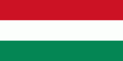
| Flag of Hungary | |
The territory of present-day Hungary has for centuries been a crossroads for various peoples, including Celts, Romans, Germanic tribes, Huns, West Slavs and the Avars. The foundation of the Hungarian state was established in the late 9th century AD with the conquest of the Carpathian Basin by Hungarian grand prince Árpád. His great-grandson Stephen I ascended the throne in 1000, converting his realm to a Christian kingdom. By the 12th century, Hungary became a regional power, reaching its cultural and political height in the 15th century. Following the Battle of Mohács in 1526, it was partially occupied by the Ottoman Empire (1541–1699). Hungary came under Habsburg rule at the turn of the 18th century, later joining with the Austrian Empire to form Austria-Hungary, a major power into the early 20th century.
Currency / Language
| ISO | Currency | Symbol | Significant figures |
|---|---|---|---|
| HUF | Hungarian forint | Ft | 2 |
| ISO | Language |
|---|---|
| HU | Hungarian language |


